
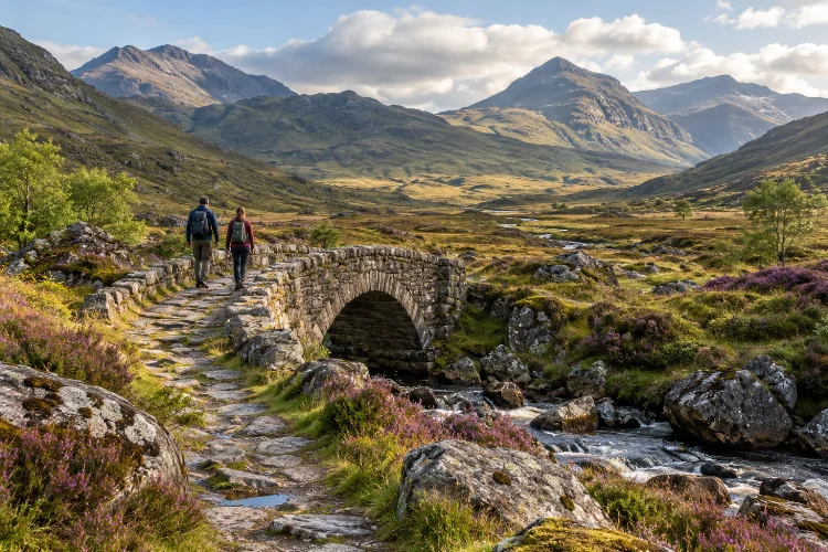
There is a big difference between seeing the Scottish Highlands and actually feeling immersed in them.
You can drive through spectacular scenery, stop at a famous viewpoint, take a few photos, and still miss most of what makes the Highlands fascinating. Slow down and follow an old track through a glen, however, and the landscape begins telling a much deeper story.
Historic Highland routes once connected settlements, cattle markets, military forts, estates, fishing communities, and remote passes. Some eventually became modern roads, while others survive as footpaths, rough tracks, old bridges, and barely visible lines across the hills.
Planning immersive Highland adventures through historic glen routes means combining hiking with history rather than treating the mountains as scenery alone.
A single journey can take you past abandoned settlements, ancient woodland, military roads, clan territories, lochs, and landscapes shaped by centuries of movement.
The good news is that you do not need to be an expedition-level mountaineer. With realistic planning, good navigation, flexible timing, and some historical research, these routes can turn an ordinary Highland trip into something far more memorable.
Why Historic Glen Routes Make Highland Travel More Immersive
Highland glens have always been natural travel corridors.
Before modern highways crossed Scotland, people generally moved through valleys, along rivers, and over the lowest practical mountain passes. Traders, soldiers, farmers, cattle drovers, messengers, and entire communities travelled these routes long before recreational hiking existed.
That history remains surprisingly visible.
A rough stone bridge may be part of an eighteenth-century military road. A wide grassy track can follow an old drove road once used to move cattle toward southern markets. A modern long-distance trail might occupy the same geographical corridor people have crossed for hundreds of years.
One of the most important transformations came during the eighteenth century.
Historic Environment Scotland notes that General George Wade oversaw around 250 miles of road and 40 bridges between 1725 and 1737, connecting places including Perth, Inverness, Fort William, and Fort Augustus.
Wade’s successor, Major William Caulfeild, was responsible for even more of the military network.
These roads were created partly to improve military control following periods of Jacobite unrest, so their history is not simply a romantic story about old paths.
That political background adds another layer to the experience.
When you walk these routes today, you are moving through geography that influenced military campaigns, Highland communities, migration, trade, and eventually tourism.
Start With the Great Glen for an Accessible Historic Journey
For travellers new to multi-day Highland walking, the Great Glen is one of the easiest places to understand how landscape and history connect.
The Great Glen Way runs between Fort William and Inverness. Scotland’s Great Trails gives the route as approximately 125 kilometres, with around 1,835 metres of total ascent and a typical walking time of five to seven days.
The route follows one of Scotland’s most dramatic geological features while passing Loch Lochy, Loch Oich, and Loch Ness. It combines canal towpaths, forest roads, paths, and sections influenced by older drove routes.
This makes it ideal for people who want an immersive experience without immediately entering extremely isolated terrain.
You are rarely cut off from civilisation for days at a time. Villages, accommodation, transport connections, and food supplies appear along the corridor, which means you can concentrate on the experience instead of carrying an expedition-sized backpack.
Add History Instead of Simply Counting Miles
The mistake is treating the Great Glen Way as nothing more than a 125-kilometre challenge.
Spend time around Fort Augustus, for example, and the relationship between geography, military strategy, roads, forts, and the later Caledonian Canal becomes much clearer.
You can also adjust the pace.
Instead of completing the trail as fast as possible, allow six or seven days and use shorter stages to explore settlements, woodland, loch shores, historical structures, and viewpoints away from the main path.
The route has also continued to evolve. In 2026, Highland Council reported the opening of route improvements near Bunloit that moved another section off-road and through woodland habitat. The council says roughly 10,000 people complete the Great Glen Way end-to-end each year.
That combination of accessible infrastructure and strong Highland character makes the Great Glen a sensible starting point before attempting rougher historic routes.
Walk Through Glen Coe With the Landscape’s History in Mind
Few Highland valleys are as visually dramatic as Glen Coe.
Steep mountains rise directly above the road, waterfalls descend from high corries, and clouds can transform the atmosphere in minutes. But stopping only for photographs misses much of its significance.
The National Trust for Scotland manages around 5,665 hectares within Glencoe National Nature Reserve. The landscape was shaped by ancient volcanic activity and later sculpted extensively by glaciers.
Human history is equally powerful.
The glen is associated with Clan MacDonald and the infamous Massacre of Glencoe in February 1692, when members of the MacDonald community were killed after soldiers had accepted their hospitality. A later parliamentary inquiry described the killings as “murder under trust.”
Learning that story before walking through the valley changes the experience.
Places that might otherwise look like anonymous hillsides suddenly become connected to people, politics, clan relationships, and events that shaped Highland memory.
Go Beyond the Main Road
One option is to explore shorter historical walks around the glen rather than simply driving along the A82.
Signal Rock, An Torr, and the approaches toward Coire Gabhail – commonly called the Hidden Valley – offer opportunities to understand how terrain influenced movement and shelter.
Sections of old military road also survive around the wider Glencoe area.
These remnants are particularly interesting because they show the contrast between eighteenth-century engineering and modern transport routes. What appears today as an isolated track once belonged to an infrastructure project designed to change how quickly troops could move across the Highlands.
Take your time here. Glen Coe is one of Scotland’s most visited landscapes, but surprisingly immersive experiences are still possible once you walk beyond the busiest roadside stops.
Follow General Wade’s Roads Over the Corrieyairack Pass
For a more serious historical adventure, the Corrieyairack Pass offers one of Scotland’s best examples of an old military road surviving in mountain terrain.
The route formed part of General Wade’s road between Dalwhinnie and Fort Augustus, constructed in 1731.
Historic Environment Scotland records the original road at approximately 45 kilometres, climbing to around 800 metres at the watershed.
Significant stretches remain unmetalled, allowing walkers to encounter something much closer to an eighteenth-century Highland route than a modern paved road.
The engineering itself is part of the attraction.
Road builders used layers of stone, constructing bridges and zigzagging uphill where necessary. The objective was practical military movement through terrain that had previously been difficult to cross quickly.
Today, that same remoteness creates the appeal.
You travel through open country where weather, distance, and lack of shelter become much more important than they seem on a computer screen.
This is not the ideal route for somebody attempting their first Highland walk.
Good navigation, suitable clothing, adequate food, water planning, and a realistic understanding of your fitness are neccessary. You also need to consider transport at both ends if you are planning a linear crossing.
But for experienced walkers, the Corrieyairack provides a rare combination: a real mountain journey where the track beneath your boots is part of the historical subject you came to explore.
Use Glen Affric for a Slower Wilderness-Style Adventure
Not every historic Highland journey needs to involve a famous military route.
Sometimes immersion comes from following natural travel corridors deeper into the landscape and noticing how old paths, estate tracks, woodland, and human settlement patterns fit together.
Glen Affric is ideal for this.
At River Affric, the public road effectively reaches its end and mountain country begins. Forestry and Land Scotland describes the area as home to wildlife including golden eagles, mountain hares, and red deer.
From there, longer routes continue west through increasingly remote territory.
The transition is part of the experience. Roads disappear, facilities become scarce, and your sense of distance changes quickly.
Forestry and Land Scotland warns that mobile reception in the glen is limited and that there are no cafés or shops within Glen Affric itself. Food and other supplies are available around places such as Cannich and Tomich instead.
That makes preparation important even when your chosen route looks straightforward.
Build a Journey Instead of a Day Trip
Rather than visiting Glen Affric for two hours, consider designing a full day or multi-day journey.
Walk through ancient pine and birch woodland, continue toward the open upper glen, and pay attention to how vegetation changes as you move farther from the road.
Experienced walkers can combine the area with longer cross-country routes toward Kintail.
For a gentler trip, base yourself near Cannich and explore different sections on consecutive days. This gives you enough time to understand the landscape instead of constantly driving toward the next attraction.
Choosing local accomodation also makes the journey feel less disconnected from the Highland communities surrounding the landscape.
Plan Your Route Around Experience, Not Instagram
Historic paths can look harmless in photographs.
A broad track crossing green hills under blue skies seems easy enough. Add low cloud, strong wind, six hours of rain, tired legs, and a swollen river, and the exact same route can become a very different proposition.
That is why good Highland adventure planning starts with your experience level.
If you are relatively new to Scotland, choose trails with obvious tracks, moderate distances, nearby settlements, and straightforward escape options. The Great Glen Way is generally more forgiving than an isolated mountain pass.
More experienced walkers can consider remote military roads, cross-glen routes, bothy trips, or long stages between road access points.
Navigation Still Matters on Established Routes
Do not assume your phone will solve every navigation problem.
Mountaineering Scotland warns that mountain weather can reduce visibility quickly and that Scotland does not have the same culture of extensive mountain waymarking found in some other destinations. A path marked on a map may not necessarily be obvious on the ground.
Download your maps for offline use before starting.
Mountaineering Scotland also recommends carrying a backup navigation method and understanding how to interpret a topographic map rather than simply following a position marker on a screen.
Batteries fail, phones become wet, screens become difficult to operate, and route conditions can force you to change plans.
A paper map and compass are not old-fashioned decorations for your backpack. In remote Highland terrain, knowing how to use them can be genuinely valuable.
Let Highland Weather Decide the Final Itinerary
One of the easiest ways to ruin a Highland trip is becoming emotionally attached to one route.
You have booked the accommodation, watched videos for weeks, and decided Tuesday will be your big mountain day. Tuesday arrives with low cloud, heavy rain, and violent wind.
Go anyway?
Sometimes the smarter adventure is somewhere else.
Mountaineering Scotland recommends using forecasts to shape your route rather than choosing a route first and merely checking what conditions you will have to endure. Strong winds can affect balance, while prolonged rainfall can raise rivers and make previously simple crossings dangerous.
This flexibility is especially useful if you stay in a central base for several days.
Poor conditions around Glen Coe might be better farther east. A stormy high-level day can become a woodland walk through Glen Affric or a lower route through the Great Glen.
Keep a primary route, a lower-level alternative, and an easy bad-wether option in mind.
That is not being overcautious. It means you are more likely to spend your trip actually enjoying the Highlands instead of fighting conditions simply because an itinerary told you to.
Season matters too.
Late spring offers long daylight hours, while summer provides even more time for extended walks. Autumn produces spectacular colours and quieter trails but increasingly short days.
Winter changes the equation completely. Snow, ice, avalanche risk, short daylight, and severe wind mean routes that are straightforward in summer may require proper winter mountaineering skills and equipment.
Combine Walking, Stories, and Local Communities
Immersive travel should not mean disappearing into the landscape while ignoring everyone who lives there.
Highland history makes far more sense when you connect walking routes with villages, museums, visitor centres, local guides, estates, cafés, community organisations, and small accommodation providers.
For example, visiting the Glencoe Visitor Centre before walking in the valley gives historical context to places you will later see outdoors.
Likewise, spending time in Fort Augustus while exploring the Great Glen helps connect old military geography with the canal and the modern settlement.
Talk to people where appropriate.
Local advice can tell you about track conditions, temporary access issues, recent storms, deer management, transport complications, or places worth visiting that never appear in a generic “Top 10 Highlands” article.
Slower itineraries also benefit the communities supporting tourism.
Instead of driving hundreds of kilometres every day, stay two or three nights in one area. Eat locally, use community services, and explore several routes from the same base.
You will probably spend less time behind a steering wheel and remember far more.
Understand Responsible Access Before Heading Into Remote Glens
Scotland gives visitors extensive opportunities to enjoy the outdoors, but those rights come with responsibilities.
The Scottish Outdoor Access Code explains that responsible access generally applies to most land and inland water for activities such as walking, cycling, climbing, swimming, kayaking, and wildlife watching. Motor vehicle access is not included in those rights
The three central principles are straightforward: respect other people’s interests, care for the enviroment, and take responsibility for your own actions.
Those principles are especially relevant on historic routes.
Old bridges, ruins, archaeological remains, and abandoned settlements are not props. Avoid moving stones, climbing unstable structures, or taking pieces home as souvenirs.
Farming and estate work also continue throughout the Highlands. Follow temporary advice around forestry operations, livestock, deer management, or other active land use.
Wild camping is possible in many areas where access rights apply, provided it is lightweight and responsible.
Current Outdoor Access Code guidance recommends camping in small numbers, generally for two or three nights in one place, staying away from buildings and roads, removing litter, managing human waste properly, and using camping stoves rather than fires in situations where fire could cause damage.
The goal is simple: when you leave a remote glen, nobody arriving afterwards should need to clean up evidence that you were there.
Turn the Route Into a Story, Not a Checklist
The best Highland adventures rarely have the largest number of stops.
They have continuity.
Instead of asking, “How many famous places can I see in five days?” ask, “What story do I want this journey to follow?”
A history-focused trip could begin around the Great Glen, explore surviving sections of military infrastructure, continue to Glen Coe, and eventually include a more demanding journey such as the Corrieyairack Pass.
A nature-focused version could connect Glen Affric with quieter woodland walks, wildlife watching, and a longer cross-glen trek.
You could also build a journey around old methods of travel. Walk part of a drove route, follow historic military roads, stay near a former coaching settlement, and explore how modern highways replaced older paths.
This approach changes how you photograph and remember the trip.
Instead of collecting isolated images of mountains, you understand why the road runs through a particular pass, why settlements appeared beside certain rivers, why forts occupied strategic locations, and why apparently empty valleys contain ruined buildings.
That is where immersion really begins.
You stop looking at the Highlands as scenery and start reading the landscape.
Planning immersive Highland adventures through historic glen routes is about much more than choosing a hiking trail.
The Great Glen, Glen Coe, Glen Affric, and historic crossings such as the Corrieyairack Pass reveal different layers of Scotland’s past, from military engineering and clan history to woodland restoration and centuries of everyday travel.
The best trips balance curiosity with preparation. Research the story behind your route, check the forecast, carry reliable navigation, allow more time than you think you need, and travel responsibly.
Most importantly, resist the temptation to rush.
Choose fewer glens, walk deeper into them, and spend enough time to understand what you are seeing. Start planning your Highland route around a story rather than a sightseeing checklist, and the journey will feel completely different.