
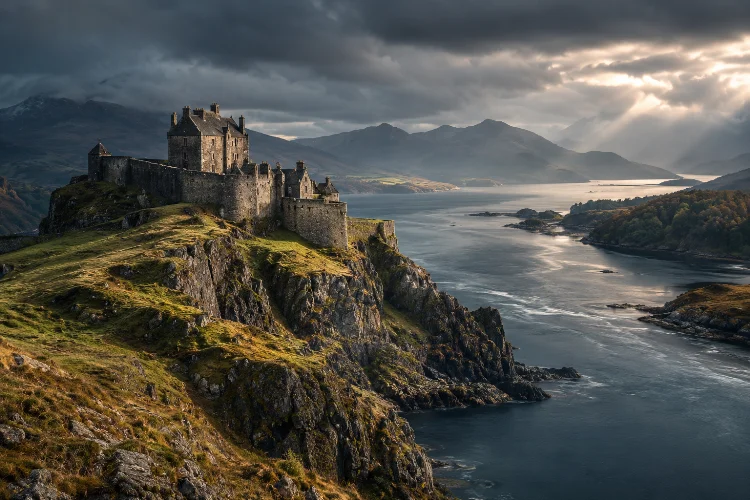
Scotland’s fortresses were rarely built somewhere simply because the view was nice.
A rocky hill above a river, a narrow coastal channel, a crossing between Highlands and Lowlands, or a harbour connected to royal territory could make one location far more valuable than another.
Control the fortress, and you could often control movement through the landscape around it.
That is what makes exploring historic Scottish fortresses and their strategic roles more interesting than simply touring old stone walls.
Edinburgh Castle dominated Scotland’s political centre from its volcanic rock. Stirling guarded one of the country’s most important river crossings. Dumbarton controlled access along the Clyde, while Tantallon used dramatic sea cliffs as part of its defensive system.
Later fortifications such as Blackness, Ruthven Barracks, and Fort George reveal how gunpowder, Jacobite rebellion, and professional armies transformed military planning.
Seen together, these sites create a timeline of Scottish defence.
They show how strategy changed from medieval castles built around height and thick walls to artillery fortresses designed around cannons, bastions, garrisons, roads, and control of entire regions.
Why Location Was Everything in Scottish Fortress Design
A castle could have enormous walls and still be strategically useless if it stood in the wrong place.
Medieval commanders understood geography extremely well. Fortresses were often positioned where natural features reduced the number of directions an enemy could attack from or where controlling a single route provided influence over a much larger area.
Cliffs, volcanic rocks, rivers, marshes, coastlines, and narrow valleys effectively became parts of the defensive architecture.
This is especially obvious at Stirling.
The castle sits high above the Forth Valley and historically controlled the lowest practical crossing of the River Forth. North-south routes converged there, making the area a natural gateway between central Scotland and the north.
Historic Environment Scotland notes that control of Stirling was so important that possession of the castle repeatedly changed during the Wars of Scottish Independence.
The same principle appears in very different landscapes elsewhere.
At Dumbarton, volcanic rock overlooks the meeting of the River Leven and River Clyde. At Tantallon, cliffs and sea protected much of the site naturally, allowing major defences to concentrate on its vulnerable landward approach.
When visiting any Scottish fortress, therefore, begin by looking away from the walls.
The surrounding landscape usually explains why the fortress exists.
Edinburgh Castle: Defending Scotland’s Political Heart
Edinburgh Castle is so familiar as a tourist landmark that it is easy to forget just how intimidating its position would have been militarily.
Castle Rock is a volcanic formation rising sharply above the surrounding city. Long before medieval kings occupied the summit, an Iron Age hill fort already used the natural defensive advantages of the location.
During the later medieval period, Edinburgh became one of Scotland’s principal royal residences.
That created an obvious strategic problem: once a site contained monarchs, royal treasure, government functions, and politically important prisoners, keeping it secure became increasingly important.
The castle was repeatedly attacked and is described by Historic Environment Scotland as having been besieged more often than any other castle in Europe.
From Royal Castle to Military Garrison
Edinburgh’s function gradually changed.
Following the Lang Siege of 1571–73, its military defences were repaired and strengthened.
The Half Moon Battery became one of the most visible symbols of the castle’s transition toward a more permanent military role, while later additions included extensive garrison accommodation and prisoner-of-war facilities.
One of the most impressive reminders of earlier artillery is Mons Meg.
The enormous six-tonne siege gun was given to James II in 1457 by Philip the Good, Duke of Burgundy.
Historic Environment Scotland records that it could fire a stone ball weighing around 150 kilograms for distances of up to two miles and was used in attacks on fortifications including Dumbarton and Norham.
The weapon demonstrates an important transition.
High medieval castles had been designed primarily to resist climbing, arrows, battering, and stone-throwing machines. Powerful cannon meant defenders increasingly needed thicker masonry, artillery positions, and redesigned approaches.
Edinburgh Castle adapted rather than becoming obsolete.
That ability to evolve explains why the site remained militarily relevant long after its main role as a royal residence declined.
Stirling Castle: The Fortress That Controlled a Country’s Crossroads
If one Scottish fortress demonstrates the relationship between geography and political power better than any other, it may be Stirling.
The castle stands around 128 metres above sea level on a volcanic outcrop overlooking the upper Forth Valley. Historically, the routes linking northern and southern Scotland converged around the river crossing below.
This made Stirling incredibly valuable during the Wars of Scottish Independence.
Edward I captured the castle in 1296. Scottish forces regained control following William Wallace and Andrew Murray’s victory at Stirling Bridge in 1297, only for control to shift again. The question of who would possess Stirling later helped lead directly to the Battle of Bannockburn in 1314.
The fortress was not merely protecting a royal residence.
It was guarding a transportation bottleneck.
Move an army through central Scotland and Stirling mattered.
A Castle With Two Personalities
Like Edinburgh, Stirling eventually became much more than a defensive structure.
Scottish monarchs transformed it into an impressive royal complex containing ceremonial halls and palace buildings. Until the Union of the Crowns in 1603, almost every Scottish monarch had either lived at Stirling, been crowned there, or died there.
That mixture of palace and fortress is what makes the site fascinating.
Walk toward the outer defences and the military logic feels obvious. Turn toward the palace buildings and suddenly the castle becomes a stage for kingship, diplomacy, ceremony, and court culture.
Strategic castles did not always exist purely for war.
The strongest sites could communicate political power without firing a weapon.
Dumbarton Castle: Guarding the Western Gateway
Dumbarton Rock has one of the longest recorded fortress histories in Scotland.
The twin-peaked volcanic formation stands where the River Leven meets the Clyde. The site was already at the centre of the ancient kingdom of Strathclyde long before Scotland developed into the kingdom we recognise today.
Its position created both opportunity and danger.
The Clyde connected western Scotland with the sea, islands, and wider Atlantic world. Control of Dumbarton therefore helped protect movement into and out of the region.
In 870, Viking kings Olaf and Ivar of Dublin attacked the fortress. After a siege lasting four months, the attackers reportedly carried captives and treasure away using a fleet of around 200 longships.
Several centuries later, Alexander II built the medieval castle around 1220 partly to protect against Norwegian power in the western islands.
After the Treaty of Perth transferred control of the Western Isles to the Scottish Crown in 1266, the nature of the threat changed. Dumbarton increasingly became a secure western refuge and departure point rather than simply a frontier defence.
That role proved useful for royalty.
David II sheltered there before travelling to France in the 1330s, while the young Mary Queen of Scots was kept at Dumbarton in 1548 before being sent to France for safety.
The castle’s history shows that strategic value was not always about stopping enemies.
Sometimes the most useful fortress provided a secure escape route.
Tantallon Castle: Letting the Sea Do Half the Defending
Tantallon Castle near North Berwick looks as though somebody deliberately searched for the most dramatic possible place to build a fortress.
The reality was also highly practical.
Built by William Douglas during the 14th century, Tantallon stands on a coastal promontory overlooking the Firth of Forth. Sea cliffs protected much of its perimeter, meaning the strongest artificial defences could focus on the landward approach.
The enormous curtain wall was designed before gunpowder artillery dominated warfare.
High, thick masonry, battlements, towers, and a deep ditch were effective responses to threats such as arrows, battering rams, and trebuchets. Openings in the main defensive wall were deliberately limited.
Then artillery changed the rules.
Later owners filled some wall chambers to strengthen the structure against cannon shot, added gun holes, and constructed extra defensive works including artillery positions outside the original wall.
It still wasn’t enough forever.
Tantallon endured royal sieges under James IV in 1491 and James V in 1528. In 1651, Oliver Cromwell’s army used heavy guns so effectively that the castle was badly damaged and ultimately abandoned as a serious fortress.
Walking around Tantallon makes the development of military technology unusually easy to understand.
Its medieval walls look enormous until you remember that powerful cannon could eventually tear them apart.
Blackness Castle: Turning Medieval Walls Into an Artillery Fortress
Blackness Castle occupies the southern shore of the Firth of Forth near what was once the port serving the royal burgh of Linlithgow.
Originally built during the 15th century for the powerful Crichton family, it quickly acquired much more serious strategic functions. It became a royal castle, military garrison, state prison, and eventually a major ammunition depot.
Its unusual shape has earned it the nickname “the ship that never sailed.”
From the water, the castle almost appears to point into the Forth like a stone vessel.
The visual effect is memorable, but the military engineering is more important.
Preparing for the Age of Cannon
James V began transforming Blackness into a major artillery fortification in 1537.
The work responded partly to the growing threat from Henry VIII’s England. Existing medieval walls were raised and massively thickened, while large gunports allowed defenders to use artillery themselves.
This was not simply a new castle replacing an old one.
It was an older fortress being adapted to survive a completely different type of warfare.
That distinction is important for understanding Scottish military architecture.
Blackness survived several attacks, but Cromwell’s heavy artillery finally demonstrated the limitations of even strengthened masonry in 1650. The bombardment devastated sections of the castle and forced the garrison to surrender.
The fortress later remained strategically useful in other ways.
It served as a prison for political and religious prisoners and became Scotland’s central munitions depot from 1870. Its military use continued until after the First World War.
Blackness therefore provides an unusually complete example of how one fortification could be repeatedly repurposed as warfare and government changed.
Ruthven Barracks: Controlling the Highlands After Rebellion
By the 18th century, military strategy in Scotland was no longer centred only on defending medieval castles.
Government forces increasingly needed permanent barracks, roads, patrols, and supply networks capable of maintaining control across the Highlands.
Ruthven Barracks near Kingussie represents that new system.
George I’s government built the barracks between 1719 and 1721 following the failed Jacobite Rising of 1715. Troops stationed there were intended to police the surrounding region and enforce the Disarming Act of 1716.
Its location was carefully chosen.
The barracks occupy a prominent mound overlooking the head of the Spey Valley and can be seen from miles away. The visual message was probably almost as important as its practical military role: government troops were now permanently present in the landscape.
The site could accommodate roughly 120 soldiers, although it may never have been fully occupied. Stables added in 1734 could hold around 30 horses for dragoons helping to protect troops travelling along the developing military-road system.
A Tiny Garrison Against 300 Jacobites
Ruthven also experienced real combat.
In August 1745, around 300 Jacobites attacked the barracks. A garrison of only 12 government soldiers managed to hold them off. The Jacobites returned with heavier weapons the following February and this time forced the defenders to surrender.
After the Jacobite defeat at Culloden in April 1746, surviving Jacobite forces regrouped at Ruthven.
There they received Bonnie Prince Charlie’s instruction that everyone should seek their own safety, effectively bringing the campaign to an end.
Few places connect geography, government control, military infrastructure, and Jacobite history so neatly.
Fort George: Building a Fortress After the Battle Was Already Won
Fort George near Inverness represents the next stage of Scottish fortress design.
Unlike medieval castles that evolved over centuries, Fort George was planned as a purpose-built modern military installation.
The government ordered its construction after the Jacobite Rising of 1745–46 and the Battle of Culloden. It was intended to become the principal garrison fortress of the Scottish Highlands and was named after George II.
Lieutenant-General William Skinner designed a sophisticated system of ramparts, bastions, ditches, firing positions, and internal military buildings.
The landward side received especially heavy defences because that was considered the most likely direction for a Jacobite attack. Seaward approaches were protected by long ramparts and smaller bastions.
The scale was enormous.
Fort George took around 22 years to complete, and by the time construction finished, the immediate Jacobite threat had largely disappeared.
That makes it one of history’s interesting ironies.
A fortress designed to prevent another major Jacobite challenge was essentially completed after that challenge had ceased to be realistic.
Yet the money was not entirely wasted.
Fort George became a recruiting and training centre for the British Army and continued in military service for centuries. It remains an active army base today.
Architecturally, the contrast with Tantallon is enormous.
Medieval designers relied on height and massive vertical walls. Fort George spreads its defences outward in carefully calculated angles, allowing defenders to cover approaches with overlapping fire.
It shows how gunpowder completely rewrote the geometry of fortification.
How Scottish Fortress Strategy Changed Over Time
Visit these fortifications in roughly chronological order and an interesting pattern emerges.
Early and medieval strongholds relied heavily on natural terrain.
Dumbarton used volcanic rock and river access. Stirling dominated a strategic crossing. Edinburgh combined an almost naturally fortified rock with political importance. Tantallon let sea cliffs reduce the amount of wall that needed serious defence.
Then cannon became increasingly powerful.
High walls alone were no longer enough.
Blackness demonstrates the awkward transitional period, when medieval masonry was thickened and modified to absorb artillery fire.
By the 18th century, places such as Ruthven and Fort George represented a different idea altogether.
Military control increasingly depended on organised garrisons, roads, supply networks, patrols, and carefully engineered artillery positions rather than noble families defending isolated castles.
The purpose changed too.
Earlier castles frequently protected royal households or aristocratic territories. Government forts after the Jacobite risings were designed to project state authority across regions.
That is a much bigger strategical shift than simply changing the shape of a wall.
Planning a Scottish Fortress History Road Trip
A fortress-focused trip can work surprisingly well because several important sites fall into natural geographical groups.
Around Edinburgh, start with Edinburgh Castle and then visit Blackness and Tantallon on seperate days or as part of wider trips along the Firth of Forth.
Stirling deserves several hours by itself.
Pair the castle with a visit to Stirling Old Bridge if you want to understand why the river crossing mattered so much. The bridge and castle make far more sense when viewed as parts of the same strategic landscape.
Toward Glasgow, Dumbarton Castle offers a completely different western story.
Continue north through the Highlands and Ruthven Barracks makes a logical stop around Kingussie before reaching Inverness and Fort George.
Do not judge travel time only by distance.
Exploring ramparts, climbing towers, reading interpretation, and simply understanding the surrounding enviroment can easily turn a one-hour stop into half a day.
Check official visitor information before leaving as well.
Historic fortifications sometimes have temporary closures because of high winds, masonry inspections, conservation projects, or military activity. Advance booking is definately worthwhile for Edinburgh Castle, where tickets can sell out during busy periods.
The goal is not to collect as many fortresses as possible.
Choose fewer sites and ask one question at each: what exactly was this place designed to control?
Once you begin doing that, walls that looked random suddenly become logical.
Exploring historic Scottish fortresses and their strategic roles reveals how closely Scotland’s military history was tied to geography and technology.
Edinburgh and Stirling used volcanic heights to dominate political centres and transport routes. Dumbarton guarded the Clyde, while Tantallon relied on coastal cliffs and enormous medieval walls.
Blackness shows how castles adapted to cannon, Ruthven reflects government efforts to control the Highlands, and Fort George represents the sophisticated artillery fortress that followed Culloden.
The most interesting part is seeing how those ideas changed.
So on your next Scottish history trip, don’t just photograph the battlements. Look at the river below, the road through the valley, the coastline, and the direction the guns were pointing.
That wider landscape is where the real strategy becomes visible.