
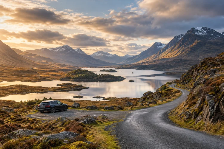
Some of the best Highland views are not found at famous attractions. They appear unexpectedly around a bend in a narrow road, beyond a lonely mountain pass, or beside a loch where there is barely enough space to pull over.
That is what makes driving through the Scottish Highlands so addictive.
A road trip gives you the freedom to move between dramatic valleys, ancient woodland, isolated beaches, open moorland, and tiny communities without being tied to a fixed tour schedule.
Better still, many of the most memorable landscapes sit beyond the places that dominate travel guides and social media.
Discovering hidden Highland landscapes along scenic driving routes is therefore less about racing around Scotland and more about learning when to slow down.
Some roads may cover only a few dozen miles, yet they can easily fill an entire day once you add short walks, viewpoints, cafés, wildlife stops, and unexpected detours.
From Glen Etive and Glen Affric to Applecross, Assynt, and the eastern Cairngorms, the Highlands reward travellers who leave enough room in their itinerary for the road itself to become part of the adventure.
Why Driving Is One of the Best Ways to Explore the Highlands
The Highlands cover an enormous area, and many of their most interesting landscapes are scattered between small villages, mountain ranges, sea lochs, and remote peninsulas.
Public transport reaches several major destinations, but a car gives you much more flexibility once you start exploring smaller roads.
That flexibility matters because Highland travel rarely follows a perfect schedule. You might notice sunlight breaking through clouds over a mountain and decide to stop. A ten-minute viewpoint can become a one-hour walk, or a small café in a village may turn into your favourite stop of the day.
Scotland also has a network of recognised scenic touring routes. VisitScotland lists drives including the North and West Highlands Route, Highland Tourist Route, SnowRoads Scenic Route, Argyll Coastal Route, and the North Coast 500.
But you do not need to complete an entire branded route.
In fact, one of the easiest ways to discover quieter places is to treat major scenic drives as a framework and then explore smaller side roads along the way.
A route that looks short on Google Maps can take considerably longer in the Highlands. Single-track roads, sheep, cyclists, photo stops, passing places, and changing weather naturally reduce your speed.
That is not a problem.
The slower pace is part of the experience.
Glen Etive: Leave the Main Glencoe Road Behind
Glencoe is one of Scotland’s most famous landscapes, which means the main A82 can become busy during popular travel periods.
Yet only a short distance away, Glen Etive offers a completely different atmosphere.
The single-track road begins near the unmistakable mountain Buachaille Etive Mòr and gradually winds south through a deep valley toward Loch Etive. VisitScotland describes it as one of Scotland’s most spectacular drives, with numerous viewpoints along the glen.
At first, the scenery feels huge.
Steep mountain slopes rise on either side while the River Etive follows the valley floor. Waterfalls drop from the hills after heavy rain, and small parking areas provide opportunities for short stops.
The farther you drive, the quieter the landscape becomes.
Eventually, the road reaches the head of Loch Etive, where mountains frame a long stretch of water disappearing toward the coast.
Don’t Rush the Glen
Glen Etive is around the kind of place where distance can be misleading.
You could technically drive in and out relatively quickly, but doing so misses most of the appeal. Allow several hours and stop only where parking is safe and permitted.
Walk beside the river, have a picnic, or simply sit somewhere quiet for twenty minutes.
One important rule is to respect passing places. They exist so vehicles can pass one another on narrow roads, not as convenient photography bays.
Traffic can also increase significantly during summer weekends. Early morning or later afternoon generally creates a calmer experience.
Glen Affric: A Scenic Road Into Ancient Highland Woodland
Many Highland drives are dominated by bare mountains and moorland.
Glen Affric feels different.
The area contains one of Scotland’s finest surviving examples of Caledonian pinewood, mixed with lochs, rivers, birch woodland, and mountains. Forestry and Land Scotland describes the whole glen as a protected National Nature Reserve.
The journey starts around Cannich, where a smaller road heads west into increasingly remote countryside.
Much of it is single track.
You eventually reach places such as Dog Falls, Loch Beinn a’ Mheadhain, and River Affric, each offering opportunities to park and continue on foot.
At River Affric, the public road effectively ends and the mountains take over. Forestry and Land Scotland notes that wildlife in the area includes red deer, mountain hares, and golden eagles.
That transition makes Glen Affric particularly satisfying.
You are not simply driving past scenery. The road gradually takes you from settled country into a landscape that feels increasingly wild.
Prepare Before Driving Deep Into the Glen
Facilities become limited once you leave the villages behind.
Forestry and Land Scotland states that there are no cafés or shops inside Glen Affric itself, while mobile phone reception can be poor. Places to eat and shop are available around Cannich and Tomich instead.
Download your maps before entering the glen and fill up with fuel well in advance.
Bringing food is also sensible if you plan to spend most of the day exploring.
A short drive can easily become an all-day outing once you add woodland trails and lochside stops.
Autumn is especially beautiful, when birch leaves turn gold and the woodland contrasts with dark hills. Spring works well too, particularly if you prefer quieter roads.
Applecross and Bealach na Bà: Driving Into Wester Ross
Few Highland roads generate as much excitement as the road over Bealach na Bà.
The Gaelic name means “Pass of the Cattle,” reflecting its origins as a historic route across the Applecross Peninsula. The pass climbs to approximately 626 metres before descending toward Applecross on the western side.
The scenery is spectacular, but the road demands attention.
It includes steep sections, tight hairpin bends, narrow stretches, and limited visibility around corners. It is not the sort of road where you should be staring continuously at the mountains while driving.
When conditions are clear, viewpoints near the higher sections can reveal an extraordinary mixture of mountains, valleys, coast, and distant islands.
After reaching Applecross, many visitors simply return the same way.
A better option is to continue around the peninsula.
The coastal road toward Shieldaig moves through a softer but equally beautiful landscape of rocky shorelines, small bays, open grassland, and views toward the Torridon mountains.
It creates a satisfying loop and shows how dramatically Highland scenery can change within a relatively small area.
Know Your Vehicle and Confidence Level
Bealach na Bà is not suitable for every driver or every vehicle.
If you are uncomfortable with narrow mountain roads, poor visibility, or reversing to the nearest passing place, there is no shame in using an alternative route.
The Highlands contain hundreds of scenic roads. There is little point turning a holiday into a stressful driving test simply because one particular pass is famous.
Check current road and weather conditions before travelling.
Rain, fog, ice, or strong winds can completely change the character of the route.
Assynt: Find Empty Roads Beyond the Famous NC500 Stops
The North Coast 500 transformed northern Scotland into an internationally recognised road-trip destination.
The complete loop covers around 516 miles and begins and ends in Inverness. VisitScotland recommends allowing at least five to seven days rather than trying to race around the route.
That advice matters.
The most interesting part of the NC500 is not completing all 516 miles. It is exploring the landscapes surrounding it.
Assynt is a perfect example.
Around Lochinver and Loch Assynt, individual mountains such as Suilven, Canisp, Quinag, and Cul Mor rise dramatically from huge expanses of moorland, rock, and water.
Rather than forming one continuous range, the peaks seem to stand seperately in an enormous open landscape.
This makes Assynt feel different from almost anywhere else in Britain.
Take the Smaller Roads
One excellent detour is the coastal route around Achmelvich, Clachtoll, and Drumbeg.
The roads are narrow and slow, but the landscape constantly shifts between turquoise beaches, rocky coastline, freshwater lochs, crofting land, and distant mountains.
Trying to drive it quickly makes no sense.
A road that appears to cover a modest distance may take hours once you add passing vehicles, photographs, beaches, and short walks.
This is where the Highlands reward patient travellers.
Instead of measuring your road trip by miles completed, measure it by how often you wanted to stop.
Drive the SnowRoads for a Different Side of the Highlands
Many visitors immediately associate Highland road trips with the west coast.
The eastern Cairngorms offer something very different.
The SnowRoads Scenic Route covers approximately 90 miles between Blairgowrie and Grantown-on-Spey, passing through areas including Braemar, Ballater, and Tomintoul. It follows some of Britain’s highest public roads.
The scenery feels more open than the steep western glens.
Wide valleys, heather moorland, rounded mountains, old stone bridges, forests, and historic villages create a landscape with a completely different rhythm.
One highlight is the Cairnwell Pass near Glenshee.
Farther north, the road crosses remote uplands toward Tomintoul, where long views make the surrounding scale easier to appreciate.
The route also includes specially designed viewpoints and art installations encouraging visitors to stop and engage with the landscape rather than simply drive through it.
The Name “SnowRoads” Is Not Just Marketing
Weather deserves serious attention here.
The route crosses high ground, and the Cairngorms National Park warns that these roads can be among the first to close when snow affects the region. Travellers are advised to check forecasts and current travel warnings.
Even outside winter, mountain weather changes quickly.
A clear morning can turn into rain, strong wind, and poor visibility within a few hours.
Keeping a flexible itinerary is therefore neccessary.
If the forecast looks rough, spend more time in lower valleys, woodland, or villages rather than forcing a high-road itinerary.
Use the North Coast 500 as a Starting Point, Not a Checklist
The NC500 is enormously useful because it connects many of the northern Highlands’ most dramatic landscapes.
It passes Wester Ross, Ullapool, Sutherland, Caithness, and the east coast before returning to Inverness.
The problem begins when people treat the route like a race.
Driving 516 miles in three days might technically be possible, but it leaves very little time for the landscapes that make the route worthwhile.
A slower strategy works better.
Choose one or two areas and explore them deeply.
Spend two nights around Torridon instead of driving straight through. Stay near Lochinver and explore Assynt’s coastal roads. Give yourself enough time around Durness to walk beaches rather than photographing them through a windscreen.
The official NC500 travel guide itself suggests taking at least five to seven days and notes that travellers with limited time can simply explore one smaller section.
That is arguably the smartest advice for anyone looking for hidden landscapes.
The quieter moments usually happen when you leave the most obvious itinerary.
Learn How Single-Track Roads Actually Work
If you have never driven on a Scottish single-track road, the first hour can feel slightly strange.
The system is simple once you understand it.
Passing places appear regularly along narrow routes. When another vehicle approaches, whichever driver is closest to a suitable passing place should normally use it.
Sometimes that means pulling in.
Sometimes it means waiting opposite the passing place so the other vehicle can use it.
You may occasionally need to reverse.
Drive far enough ahead mentally that this never becomes a surprise.
Forestry and Land Scotland specifically advises drivers in Glen Affric to travel slowly and use passing places to allow vehicles to pass.
Never park in them.
Blocking a passing place because the nearby view looks beautiful can create traffic problems surprisingly quickly.
If a faster local driver appears behind you, allowing them to pass is also good etiquette. Residents may be commuting, working, collecting children, or simply trying to get home.
For visitors, the road is part of the holiday.
For local people, it is everyday infrastructure.
Stop Walking Distance From the Car
One simple trick can completely change a Highland road trip: occasionally walk away from the road.
Many travellers stop, take a photo beside the vehicle, and continue.
Walk twenty minutes instead.
A short woodland trail, beach path, riverbank, or hillside track often removes most of the traffic noise and reveals scenery invisible from the road.
Glen Affric is particularly good for this approach because several parking areas connect directly with walking trails.
The same idea works around Glencoe, Assynt, Torridon, and the Cairngorms.
You do not need a major mountain hike.
A relaxed one-hour walk can provide more connection with the landscape than driving another hundred miles.
Keep waterproof clothing and walking shoes in the car so spontaneous stops remain possible.
A flask, snacks, and a small daypack are useful too.
Highland weather has a habit of turning “we’ll only be out for ten minutes” into something considerably wetter.
Plan Fuel, Food, and Accommodation Before You Need Them
Remote road trips become stressful when basic planning is ignored.
Fuel stations may be much farther apart than you expect, particularly in northern and western areas.
VisitScotland’s NC500 guidance recommends fuelling regularly, carrying offline maps, and booking accomodation in advance, especially on popular routes.
Do not wait until the fuel warning light appears before looking for a petrol station.
Likewise, a village shown prominently on a map may have limited food options or opening hours.
Keep some water and basic food in the vehicle.
Offline navigation is equally useful.
Mobile reception disappears surprisingly quickly in remote glens. Glen Affric, for example, has areas with little phone reception.
Downloading your route before leaving Wi-Fi takes only a minute and can prevent unnecessary confusion later.
A paper map is also useful when planning detours because it gives you a better sense of the surrounding geography than a small phone screen.
Choose the Right Season for a Highland Driving Trip
Every season creates a different road-trip experience.
Late spring is excellent for long daylight hours and fresh landscapes. May and early June can feel particularly spacious before peak summer travel reaches full intensity.
Summer gives you maximum daylight and the widest choice of open attractions, restaurants, tours, and accomodation.
It is also the busiest period.
Famous roads around Glencoe, Applecross, and the NC500 can see significant traffic, especially during weekends and holiday periods.
Autumn changes the atmosphere completely.
Wooded areas such as Glen Affric become especially colourful, while lower visitor numbers can make scenic roads feel calmer.
Days become shorter, though, so route planning matters more.
Winter can be beautiful but requires much more caution.
Snow and ice may close higher roads, daylight is limited, and storms can make isolated routes unpleasant or unsafe. The high SnowRoads network is particularly vulnerable to winter weather.
Whatever month you choose, build flexibility into your schedule.
The Highlands are much more enjoyable when the wether influences your plan rather than ruins it.
Drive Responsibly Through Fragile Highland Landscapes
Remote scenery can create the impression that nobody owns or manages the landscape.
That is rarely true.
The Highlands include working farms, crofts, estates, forestry areas, conservation sites, villages, nature reserves, and private homes.
Travel respectfully.
Use designated parking wherever possible. Never block gates, narrow roads, driveways, or passing places just because you want a photograph.
VisitScotland encourages road-trip visitors to remove litter, plan accomodation ahead, use appropriate camping areas, and follow the Scottish Outdoor Access Code.
Supporting local businesses matters as well.
Buying lunch in a village café, filling up at an independent petrol station, staying in a locally run guesthouse, or booking a local wildlife guide keeps more tourism income within Highland communities.
Slower travel naturally makes this easier.
When you spend several nights in one region instead of racing across the country, you discover more businesses, meet more people, and put less pressure on the enviroment.
Discovering hidden Highland landscapes along scenic driving routes is not about finding one secret road that nobody else knows.
It is about travelling differently.
Glen Etive, Glen Affric, Applecross, Assynt, the SnowRoads, and quieter sections of the North Coast 500 all prove that the most rewarding moments often happen between major attractions.
Plan fewer miles, leave time for unexpected stops, learn how to use single-track roads, check fuel and weather before entering remote areas, and occasionally leave the car behind for a short walk.
Most importantly, avoid turning your road trip into a race.
Choose a region, slow down, and follow the road wherever the landscape starts looking interesting. The Highlands become far more memorable once the journey itself matters as much as the destination.