
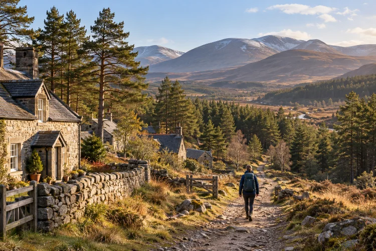
The Cairngorms are the kind of place where a simple morning walk can quietly turn into an entire day outdoors.
One minute you are drinking coffee in a small Highland village. An hour later, you might be following a pine forest track toward an open glen, watching clouds move across mountains with almost no buildings in sight.
That contrast is what makes exploring the Cairngorms through remote villages and mountain trails so rewarding.
Instead of treating the national park as one big wilderness destination, you can use its smaller communities as comfortable bases and gradually venture deeper into the landscape.
The Cairngorms National Park covers roughly 4,528 square kilometres, making it the largest national park in the UK. It is home to around 18,000 residents, while nearly half of the park is classified as wild land.
From Nethy Bridge and Tomintoul to Braemar, Kincraig, and Dalwhinnie, each village offers a different doorway into forests, rivers, moorland, historic routes, and serious mountain country.
The best way to experience it is slowly.
Why the Cairngorms Reward Slow Exploration
The Cairngorms are too large to understand from a single viewpoint.
The park stretches across parts of Aberdeenshire, Angus, Highland, Moray, and Perth and Kinross, creating a landscape that changes dramatically depending on which side you approach from.
Pine forests and broad river valleys dominate some areas, while the interior contains high plateaus, deep glens, and exposed mountain terrain.
That scale is exactly why staying in smaller villages works so well.
Rather than driving back to one busy tourism hub every evening, you can divide a trip into several local areas. Spend a couple of nights near the Spey, move toward the eastern villages, then finish around Deeside or one of the quieter western settlements.
This creates a much stronger sense of place.
The Cairngorms National Park Authority lists more than 100 local paths and trails across the park, many starting directly from towns and villages.
Routes range from easy riverside walks to strenuous hills, and many include information about terrain and accessibility before you begin.
That makes the region unusually good for mixed-ability trips.
You can enjoy a relaxed forest trail in the morning, attempt a steeper hill the next day, and leave serious mountain terrain for when the forecast and your experience level are both appropriate.
The key is not trying to “complete” the Cairngorms.
You cannot.
The more satisfying goal is to understand one corner at a time.
Nethy Bridge and Abernethy Forest: Start Among the Pines
Nethy Bridge is easy to overlook when compared with larger places such as Aviemore, but that is part of its appeal.
The village sits in Strathspey beside the River Nethy and close to Abernethy Forest, one of the largest areas of Caledonian pine forest in Scotland. Its connection with the woodland is so strong that Nethy Bridge is sometimes known locally as the “Forest Village.”
The village itself has enough practical facilities to make a useful base, including accommodation, a shop, a café, and community facilities.
Yet within a short distance, the environment feels much wilder.
Follow the Old Logging Landscape
One of the nicest things about Nethy Bridge is the variety of walks available without needing a major mountain expedition.
The local path network includes forest trails, riverside routes, the Castle Roy Loop, and the Puggy Line trail. The latter follows part of an old logging railway, giving what looks like a simple woodland walk a surprisingly interesting historical layer.
The Speyside Way also passes through the village, connecting Nethy Bridge with Boat of Garten and Grantown-on-Spey.
That means you can use the village for a longer point-to-point walk without climbing high into the mountains.
Wildlife is another reason to move slowly here.
The surrounding forest provides habitat for species including red squirrels, pine martens, and Scottish crossbills. Sightings are never guaranteed, obviously, but walking quietly early in the morning gives you a much better chance than rushing through the woods in the middle of a busy afternoon.
Nethy Bridge works particularly well for the first couple of days of a trip.
It lets you settle into the rhythm of Highland walking before tackling longer or more exposed routes.
Braemar: A Mountain Village at the Southern Gateway
Braemar feels different almost immediately.
Surrounded by hills near the River Dee, the village sits in the heart of the eastern Cairngorms and has been strategically important for centuries because of its proximity to mountain passes.
Today, it offers cafés, shops, accomodation, local history, and a surprisingly useful network of trails beginning close to the village centre.
That combination makes Braemar ideal for travellers who want serious mountain scenery without sleeping in complete isolation.
You can have breakfast in the village, walk for several hours, then return for dinner without getting back into a car.
Begin With Creag Choinnich or Queen’s Drive
Not every mountain experience needs to involve a Munro.
Creag Choinnich rises directly above Braemar and provides a short but steep introduction to hillwalking. The official route is around 2.5 kilometres return and reaches a high point of 538 metres, offering panoramic views without requiring an all-day expedition.
For something gentler, Queen’s Drive follows part of a carriage route associated with Queen Victoria.
The circular route is approximately 4.5 kilometres and usually takes around 90 minutes. It follows sections beside Clunie Water and provides good views back toward the village and surrounding hills.
These smaller routes are useful for more than sightseeing.
They let you judge trail conditions, test your footwear, and see how quickly Highland wether can change before committing to longer adventures.
From Braemar, more experienced walkers can eventually push deeper toward the mountain interior through the wider Deeside landscape.
But there is no need to rush.
One of the smartest ways to travel here is to alternate demanding days with short local walks.
Your legs will appreciate it, and you will notice far more about the village itself.
Tomintoul and Glenlivet: Quiet Roads, Big Skies, Gentle Trails
Tomintoul sits on a quieter side of the Cairngorms.
It is the highest village within the national park and was established in 1775 as a planned settlement. Its grid-style centre and traditional buildings still reflect those origins.
The surrounding landscape feels more open than the forest-heavy areas around Strathspey.
Wide valleys, moorland, distant peaks, farmland, and quieter roads create a different type of Highland scenery.
Tomintoul also has enough services to be practical.
There are cafés, pubs, shops, and accommodation, while the community-run discovery centre provides local information and advice.
Explore Before Heading for Bigger Hills
The recently updated network of paths around Tomintoul makes it easy to begin locally.
One circular route passes through countryside around the village and includes views across the River Avon toward Ben Avon. Surfaces include grassy tracks, quiet roads, gates, and rural paths.
This is exactly the kind of walk that often gets ignored in favour of famous mountain summits.
That is a shame.
Lower routes allow you to notice old field boundaries, farms, birdlife, historic tracks, and the way local communities sit within the landscape. They also remain useful when cloud makes the higher mountains unattractive.
Tomintoul is linked to Braemar and other eastern communities by the SnowRoads scenic route.
The full route covers around 90 miles between Blairgowrie and Grantown-on-Spey, crossing some of Britain’s highest public roads and connecting places including Braemar, Ballater, and Tomintoul.
Driving it slowly makes an excellent addition to a walking trip.
Just remember that the word “SnowRoads” is not decorative. Conditions can change quickly on higher sections, especially outside summer.
Dalwhinnie and Kincraig: Explore the Quieter Western Edge
The western Cairngorms offer another useful contrast.
Dalwhinnie sits near the head of Glen Truim, surrounded by mountains and close to the A9. Despite its remote appearance, it remains relatively easy to reach by road and rail.
Historically, the area was connected to cattle droving routes.
The name Dalwhinnie comes from Gaelic associated with a meeting place, reflecting its location where travellers and drovers once gathered before crossing difficult terrain around the Pass of Drumochter.
Today, there are several local trails around the village covering woodland, Loch Ericht, and mountain viewpoints.
This makes Dalwhinnie useful as a quieter stop rather than simply somewhere to pass on the A9.
Kincraig Offers Forests, Lochs, and Easy Connections
Farther north, Kincraig sits near Loch Insh at the foot of the Cairngorms.
It is smaller and calmer than Aviemore, but it provides access to a surprisingly varied trail network.
Local routes explore the village, farmland, woodland, riverside scenery, Feshiebridge, Inshriach Forest, and the Uath Lochans area. The official park guide notes that the Uath Lochans can even be reached from Kincraig along the Speyside Way.
The section of the Speyside Way between Kincraig and Aviemore is around 11 kilometres.
It passes through native woodland with mountain views and can be completed as a moderate day walk, making it a good option for travellers who want to combine village-to-village walking with public transport or a pre-arranged return.
This is an excellent example of how to experience the Cairngorms without constantly driving.
Leave from one community, travel on foot through the landscape, and finish somewhere different.
Suddenly the journey itself becomes part of the trip.
From Village Paths to Serious Mountain Trails
One of the Cairngorms’ biggest strengths is the natural progression from easy paths to genuine mountain terrain.
A traveller with limited experience can spend several days on woodland routes, lochside walks, and small hills before deciding whether to go higher.
For experienced hikers, the possibilities expand dramatically.
The national park contains more than 50 Munros along with remote mountain tracks and high plateau landscapes. Routes can lead into exposed terrain where shelter is limited and navigation becomes much more demanding.
Popular mountain gateways include Glenmore, Rothiemurchus, Braemar, Deeside, and the glens extending into the central massif.
Classic passes such as the Lairig Ghru show just how quickly a familiar Highland forest can give way to a huge, austere mountain landscape.
Don’t Confuse a Visible Path With an Easy Route
This is where visitors occasionally get caught out.
A track may begin wide and obvious beside the trees, then become rougher as it enters open country. Cloud can lower onto the plateau, temperatures can drop, and landmarks can disappear.
Mountaineering Scotland warns that navigation in Scottish mountains can be challenging because visibility can deteriorate quickly.
It also notes that Scotland does not have the extensive culture of mountain waymarking found in some destinations, and a path shown on a map may not always be obvious on the ground.
Your phone is useful, but it should not be treated as magic.
A Mountaineering Scotland survey of more than 4,000 walkers found that 87% had used phones or GPS for navigation, and more than 40% of those users had experienced a situation where the technology stopped working in some way.
Download topographic maps in advance, protect your phone from cold and rain, carry additional power, and have a separate backup system.
For remote mountain routes, knowing how to use a map and compass remains neccessary.
Practical Planning: Transport, Weather, and Responsible Access
You do not need a car for every Cairngorms adventure.
Railway stations within the national park include Blair Atholl, Dalwhinnie, Newtonmore, Kingussie, Aviemore, and Carrbridge. Bus services connect a number of communities, and the Aviemore Adventurer service links Aviemore with Cairngorm Mountain.
That opens up some interesting possibilities.
You can stay in one village and use public transport to start a linear walk elsewhere, or combine trains, local buses, and walking rather than moving the car every day.
Schedules become thinner in more remote places, though.
Always check the return journey before beginning a long route rather than assuming another bus will appear later.
Let the Forecast Choose the Trail
Weather should influence your route from the beginning.
Mountaineering Scotland recommends using the mountain forecast to make your plans rather than choosing a fixed mountain route first and then checking whether the conditions happen to suit it. Strong wind, rain, poor visibility, and cold temperatures can transform an otherwise straightforward day.
A useful Cairngorms itinerary therefore needs alternatives.
If the high mountains disappear into cloud, walk through Abernethy Forest. If wind makes an exposed ridge unpleasant, explore paths around Braemar or Kincraig.
Being flexible does not mean losing a day.
Often the lower-level alternative becomes one of the most enjoyable parts of the trip.
Check Current Trail Alerts
Conditions on specific trails can change because of storms, wildfire, forestry work, erosion, or maintenance.
The park’s official trail pages currently carry alerts for several areas, including temporary closures associated with wildfire damage around parts of Glenmore.
This is a useful reminder to check official information shortly before setting out rather than depending entirely on an old blog or downloaded itinerary.
This matters especially if you are visiting months after planning your trip.
Highland landscapes are not static attractions.
They are working, changing environments.
Travel Responsibly in a Fragile Mountain Environment
Scotland’s outdoor access rights give visitors enormous freedom.
Responsible access generally applies across most hills, forests, moors, rivers, lochs, and other outdoor areas. Walking, cycling, climbing, wildlife watching, and responsible lightweight camping are among the activities covered, subject to common-sense exceptions and responsible behaviour.
The principles are straightforward: respect other people, care for the environment, and take responsibility for your own actions.
In the Cairngorms, wildlife makes that particularly important.
The park contains around a quarter of the UK’s rare and endangered species, which means seemingly empty ground may actually be sensitive habitat.
Keep dogs under close control and follow local signs, especially during bird breeding periods.
Do not disturb wildlife simply to get a closer photograph.
Know the New Fire Rules
There is also an important current rule visitors should understand.
From 1 April to 30 September each year, fires and barbecues are banned within Cairngorms National Park under the Fire Management Byelaw, which came into force in 2026. Breaching the byelaw can result in a fine of up to £500.
Camping stoves can still be used responsibly.
For wild camping more generally, the Scottish Outdoor Access Code recommends small-scale, lightweight camping, usually for only two or three nights in one location, away from buildings and roads, with no trace left behind.
Carry everything out.
That includes food packaging, tissues, and anything else you carried in.
Remote landscapes only stay beautiful when visitors stop assuming that someone else will clean them up.
Exploring the Cairngorms through remote villages and mountain trails is one of the best ways to understand how diverse this part of Scotland really is.
Nethy Bridge opens onto ancient pine forest, Braemar sits beneath serious mountain country, Tomintoul offers quiet upland landscapes, while Kincraig and Dalwhinnie provide completely different gateways from the west.
The secret is to build your trip gradually.
Start with village paths, add longer forest and valley routes, and move into high mountain terrain only when your skills and the conditions make sense. Use local communities as places to stay, eat, learn, and slow down rather than treating them as parking areas before a hike.
Choose two or three villages, leave some empty space in your itinerary, and follow whichever trail looks interesting that morning.
That is often where the best Cairngorms adventures begin.